David Hopkins, County Archaeologist for Hampshire County Council, writes about the importance of LiDAR in enhancing our knowledge of the South Downs Landscape.
The National Planning Policy Framework seeks to protect and enhance, amongst other things, our historic environment. The planning system is reliant on the evidence collated in HERs – the Historic Environment Record – a dynamic database recording archaeological, landscape and built heritage information. This information comes from a wide range of sources; chance discoveries; development and community related archaeological projects; Maps and aerial photographs offer an opportunity to search whole landscapes for clues.
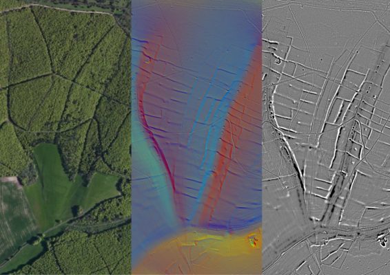
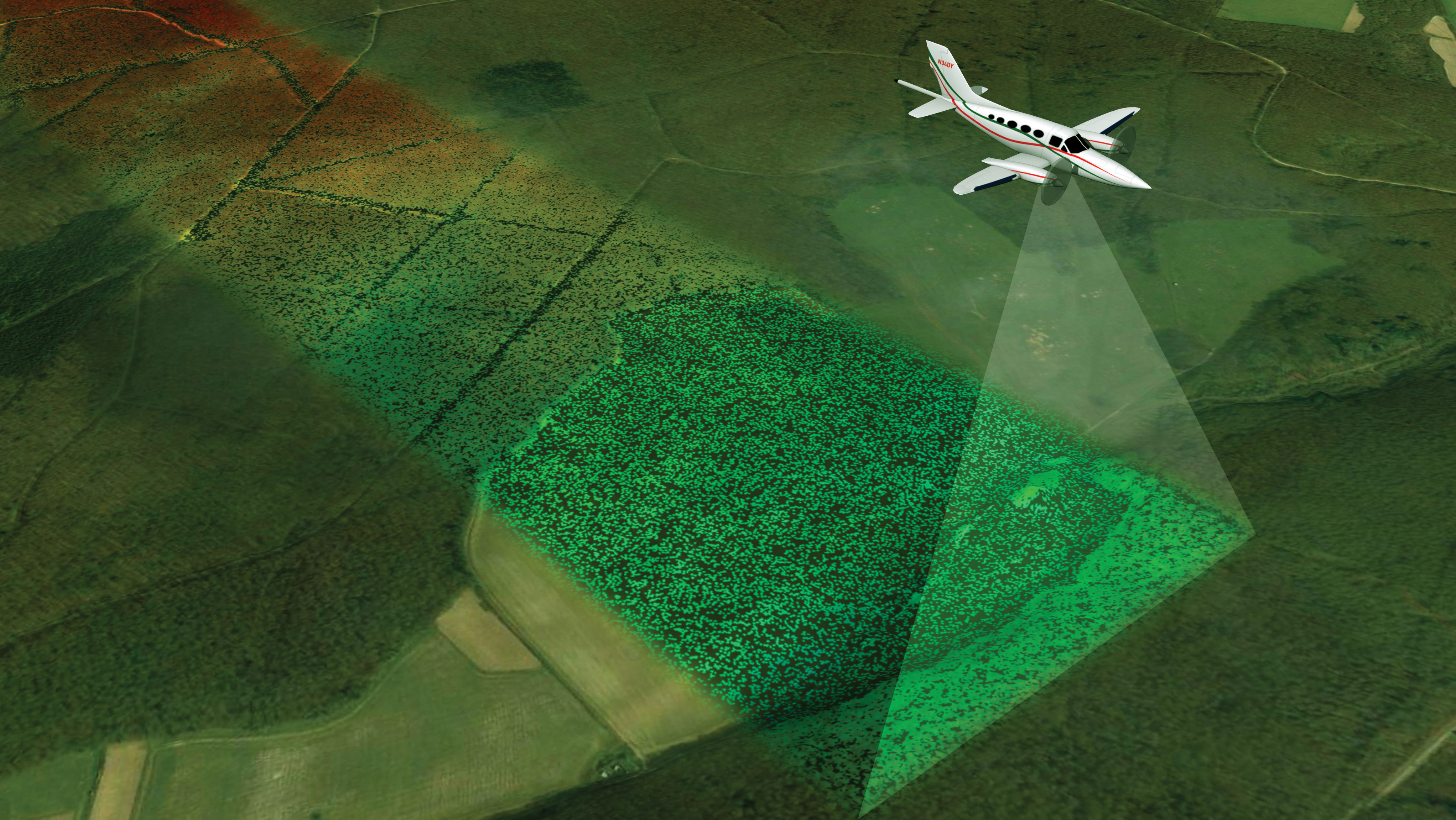
Aerial photographs in particular can include soil marks and cropmarks that portray buried archaeological sites but find it harder to reveal earthworks, unless the light is low and raking. Where there is tree canopy cover it may not be possible to see the ground at all. But in recent years HERs have been able to use LiDAR, light detection and ranging. Measuring laser light between an aircraft and the ground reveals earthworks. But over woodland if the data is processed to deduct the first return (the light that bounced off the tree canopy) from the last return, (the light that bounded off the ground) it is possible to see the archaeology beneath the canopy, so the trees no longer prevent the prying eyes of archaeologists.
The Hampshire HER has been reviewing the public access LiDAR, which has provided a once in a lifetime opportunity to enhance the data available on the HER. Woodlands have been searched for the banks and lynchets of prehistoric field systems, burial mounds and settlements revealed by LiDAR images, and the field systems and lost boundaries of the wider landscape have also been plotted. LiDAR has provided a new layer evidence to support HERs and the planning system.