
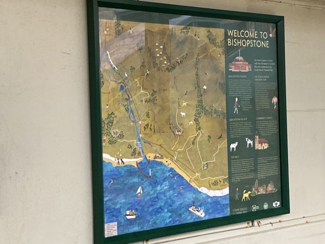
Exploring the National Park after stepping off the train has just been made easier, thanks to a new integrated travel map.
The colourful map has been installed at Bishopstone station in East Sussex to encourage visitors to explore the wider area.
The map shows visitors a range of nearby leisure pursuits from walking, cycling and horse-riding to swimming, sailing and sunbathing. It highlights rail and bus connections to and from the station on the Seaford to Brighton line in East Sussex.
The map is a joint project between the South Downs National Park Authority, Community Rail Network, Southeast Communities Rail Partnership and the Friends of Bishopstone Station.
Speaking at the launch of the map, Robert McGowan, project manager, said: “This project was a lot of fun to work on.
“I think the illustrated map gives an impression of what the landscape actually feels like – how the station is connected to the beach, the old village and the Downs.”
 Allison Thorpe, who leads access and recreation for the National Park, said: “Stations like Bishopstone are gateways to the South Downs National Park.
“That is why we were so pleased to work with the Friends of Bishopstone Station and the Community Rail Partnership to give people ideas for walks to the countryside and historic villages in the Downs and to show people how easy it is to explore the National Park by rail.”
Barbara Mine, chair of the Friends of Bishopstone Station, added: “We are so pleased to have received this integrated travel map. It puts people in the picture as to where they are and where they want to go to.”